




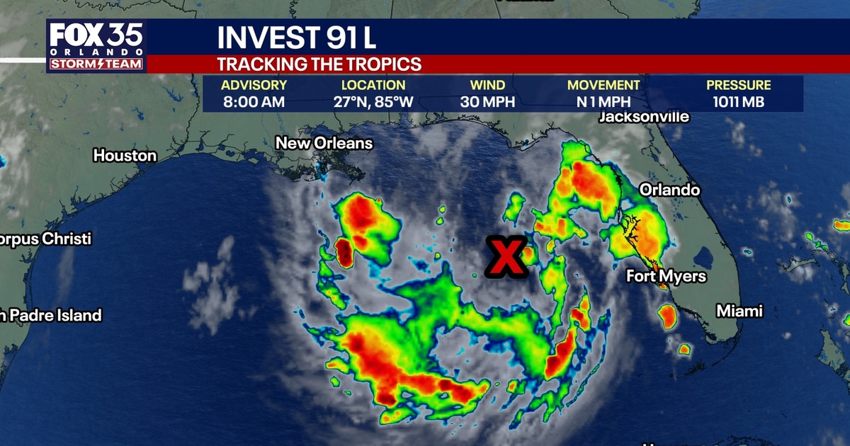

ORLANDO, Fla. – Tropical Depression 2 has now formed in the northern Gulf and is expected to organize further in the hours ahead. NHC Hurricane Hunters will be deployed this afternoon to gather more data on this system as it continues to develop.
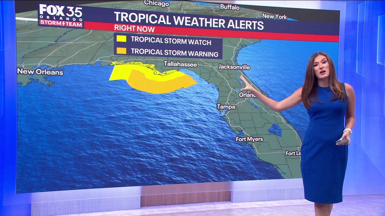
As we progress through the next 24 hours, as the Storm Team has been mentioning, Tropical Storm Bertha will likely form. Tropical Storm Watches and Warnings have been issued for parts of the Gulf, including the Panhandle of Florida.
There is some wind shear in the northern Gulf though, but as this storm works west, it will start to work into an area of lower shear. That could aid in more strengthening, which is what we’ll be watching.
DEVELOPMENT CHANCES INCREASING
That is the big change with this developing disturbance. There is also an 80% chance of development over the next 7 days. The Gulf water is warm and that heat is fueling the organization further. We could see a tropical depression before the weekend wind to a close with “Potential Bertha” possible by Monday.
There is some wind shear in the northern Gulf though, but as this storm works west, it will start work into an area of lower shear. That could aid in more strengthening, which is what we’ll be watching.

GULF COAST IMPACTS
The northern and even western Gulf should continue to monitor this system closely as it eventually starts to shift westbound. The Panhandle of Florida through the Gulf Coasts of Alabama, Mississippi, and Louisiana could see Tropical Storm Watches issued as gusty wind and heavy rain become a real possibility.
Rainfall amounts along the Gulf Coast could top out beyond half a foot in some spots, depending on how close the low pressure center gets to the beaches.
CENTRAL FLORIDA IMPACTS SUNDAY INTO MONDAY
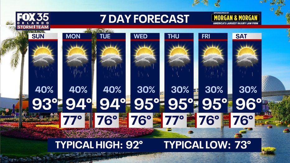
As this area of low pressure continues to develop in the Gulf, we’ll be on the outer periphery of the heavier tropical moisture. That doesn’t mean we can’t get some tropical rain though, as more moisture streams into the state. This system, with the help of the upper-level flow, will start to shift to the NW, taking the heavier rain along with it. Hit-or-miss tropical downpours and storms are still on the table, mainly this afternoon into the evening. Monday looks similar. We’ll start the day off dry, but we’ll see outer rain bands circulating storms and downpours through Central Florida during the afternoon into the evening.
LOW RISK OF SEVERE WEATHER
A couple storms could turn stronger to even severe later this afternoon into the evening, which is something we’ll be watching. The main hazards would be smaller hail and gusty wind. A brief tornado can’t be completely ruled out though, especially with a boundary collision, and a bit more wind energy. We do it all over again on Sunday with a few showers and storms around during the afternoon into the evening.
There’s no risk of severe weather for Monday right now, but a few strong storms to even severe storms are still a possibility.
HOW MUCH RAIN?
Rainfall totals will be the heaviest across the Gulf Coast with the lightest amounts on our East Coast Beaches. Amounts on the Gulf side could top out beyond 3″, depending on who gets in on the downpours. Farther to the east, across the Orlando Metro, we’ll likely see around 0.5-1″ with isolated higher amounts possible. The closer you get to the Space Coast, amounts will trend down toward 0.25–0.50″ or so.
That is the big change with this developing disturbance. There is also a 80% chance of development over the next 7 days. The Gulf water is warm and that heat is fueling the organization further.
We could see a tropical depression before the weekend wind to a close with “Potential Bertha” possible by Monday. There is some wind shear in the northern Gulf though, but as this storm works west, it will start work into an area of lower shear. That could aid in more strengthening, which is what we’ll be watching.
The Source: This story was written based on information provided by the National Hurricane Center on July 19, 2026.